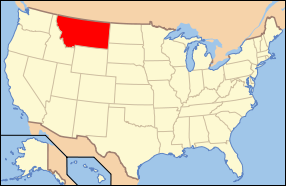
With a land area of 145,552
mi˛ (376,978 km˛) the state of Montana is the fourth largest in
the United States(after Alaska, Texas, and California). To the north,
Montana and Canada share a 545-mile(877 km) border. The state borders
the Canadian provinces of British Columbia, Alberta, and Saskatchewan,
more provinces than any other state.
To the east, the state
borders North Dakota and part of South Dakota. To the south is Wyoming
and to the west and southwest is Idaho. The topography of the state
is diverse, but roughly defined by the Continental Divide, which
runs on an approximate diagonal through the state from northwest
to south-central, splitting it into two distinct eastern and western
regions.
Montana is well known
for its mountainous western region, part of the northern Rocky Mountains.
However, about 60% of the state is actually prairie, part of the
northern Great Plains. Nonetheless, even east of the Continental
Divide and the Rocky Mountain Front, there are a number of isolated
"Island Ranges" that dot the prairie landscape.
The Bitterroot Mountains
divide the state from Idaho to the west with the southern third
of the range blending into the Continental Divide. Mountain ranges
between the Bitterroots and the top of the Continental Divide include
the Cabinet Mountains, the Missions, the Garnet, Sapphire, Flint
Creek, and Pintlar ranges.


