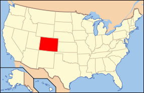
Colorado is one of only
three U.S. states (with Wyoming and Utah) that have only lines of
latitude and longitude for boundaries. The summit of Mount Elbert
at 4401 meters (14,440 feet) elevation in Lake County is the state's
highest point and the highest point in the entire Rocky Mountains.
Colorado has approximately 550 mountain peaks that exceed 4000 meters
(13,123 feet) elevation. Colorado is the only U.S. state that lies
entirely above 1000 meters (3281 feet) elevation.
The state's lowest elevation
is 1010 meters (3315 feet) at the point on the eastern boundary
of Yuma County where the Arikaree River flows into the State of
Kansas. East of the Southern Rocky Mountains are the Colorado Eastern
Plains of the High Plains, the section of the Great Plains within
Colorado at elevations ranging from 3315 to 6562 feet (1010 to 2000
meters).
The states of Kansas
and Nebraska border Colorado to the east. The plains are sparsely
settled with most population along the South Platte and the Arkansas
rivers. Rainfall is meager, averaging from 12 to 18 inches (300
to 450 millimeters) annually. There is some irrigated farming, but
much of the land is used for dryland farming or ranching. Winter
wheat is a typical crop and most small towns in the region boast
both a water tower and a grain elevator.
The bulk of Colorado's
population lives along the eastern edge of the Rocky Mountains in
the Front Range Urban Corridor. This region is partially protected
from prevailing storms by the high mountains to the west. To the
west lies the eastern slope of the Rocky Mountains with notable
peaks such as Longs Peak, Mount Evans, Pikes Peak, and the Spanish
Peaks near Walsenburg in the south. This area drains to the east,
is forested, and partially urbanized. With urbanization, utilization
of the forest for timbering and grazing was retarded, which resulted
in accumulation of fuel. During the drought of 2002 devastating
forest fires swept this area.


